Bachelor of Geomatics Engineering with Honours
Geomatics Engineering is an academic discipline that concerns on acquisition, analysis, and interpretation of mainly geospatial data, relating to the Earth, its physical features and the built environment. It comprises tools and techniques of measuring, managing, presenting and analysing geospatial data from diverse sources with well-defined characteristics on accuracy and continuity; and in the form of digital format. Geospatial data are obtained from a wide range of technologically advanced tools like total station, Global Positioning System (GPS) / Global Navigation Satellite System (GNSS) equipment, digital aerial imagery (from both satellite and airborne), Terrestrial Laser Scanner (TLS), Unmanned Aerial Vehicle (UAV), echo sounder and Ground Penetrating Radar (GPR). These data are processed and manipulated by using a computer and the latest software. Also included in the area of geospatial are computer-based Geographic Information Systems (GIS) and remote sensing for monitoring the environment.
Bachelor of Geomatics Engineering with Honours is one of the oldest programme in UTM. It was first introduced in the early 1970s. Prior to 1994, the programme was known as Bachelor of Surveying (Land). This bachelor programme strives to deliver a quality educational experience via emerging geomatics technologies towards providing a significant contribution to the needs of the surveying and Geomatics Engineering profession nationwide.
Career Prospects
- Licensed Land Surveyor
- Government Land Surveyor
- Geodesist
- Hydrographer (offshore & onshore positioning specialises in marine hydrographic survey and oceanography)
- Astronomer & Islamic Astronomer (Falak Syarie)
- Photogrammetrist
- Researcher
- Academician
- Geospatialist (government public sector & private firm)
- Geomatics Engineer (e.g., oil, gas & mineral exploration, construction, energy & utilities, land-use planning, three dimensional (3D) imaging, and positioning technology)
List of government agencies and local authorities that continuously require this profession are: | List of private sectors (local & international) that continuously require this profession are: |
l Department of Survey and Mapping Malaysia (DSMM) / Jabatan Ukur dan Pemetaan Malaysia (JUPEM) l Jabatan Tanah dan Survei Sarawak / Land and Survey Department, Sarawak / l Land and Survey Sabah/ Jabatan Tanah dan Ukur Sabah l Malaysia Space Agency / Agensi Angkasa Malaysia (MYSA) l Pusat Hidrografi Nasional Malaysia l Jabatan Laut Malaysia l Jabatan Perhutanan l Higher education institution (Universities and Polytechnic) l Jabatan Kemajuan Islam Malaysia (JAKIM)
| l PETRONAS Carigali Sdn Bhd l Tenaga Nasional Berhad (TNB) l Telekom Malaysia l Licensed land surveying firm in Malaysia l Construction, plantation or logistics firms (e.g., Sime Darby Berhad, YTL Corporation Berhad) l Land surveying equipment & system supplier l Related offshore and onshore oil & gas operating companies (e.g.,FUGRO, SHELL, Sapura Energy) l Private geomatics university college
|
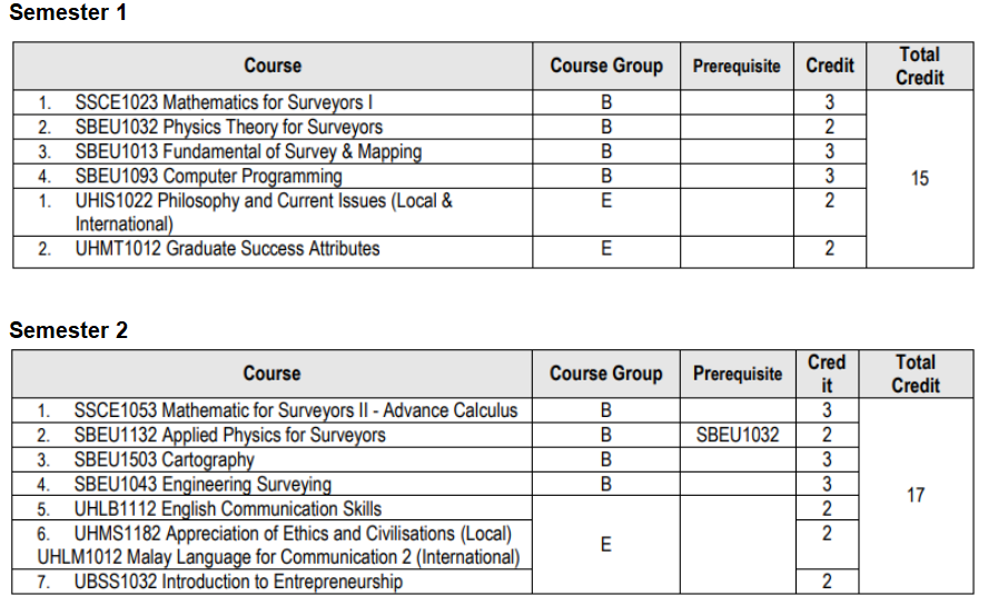
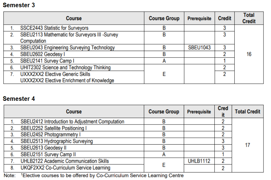
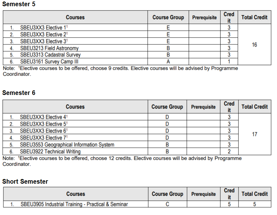
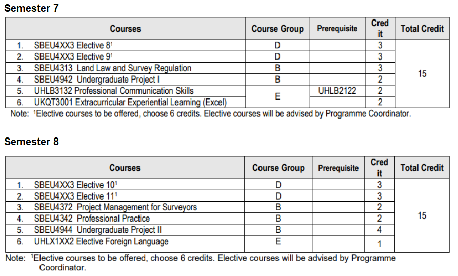
Program Structure
